Our Illustrated Maps
We have 24 years experience working with clients in the tourism and heritage sectors creating accurate, hand-drawn illustrated maps that will inspire your visitors to explore your site and stay longer.
We work with you to create beautifully illustrated bespoke maps to meet your requirements, including: visitor maps and site plans for museums, castles, galleries and visitor attractions, illustrated garden, grounds and site maps for historic houses, fun maps for children and families, and detailed maps for publishing and editorial.

Beamish
Hand illustrated site map for Beamish showing the layout, route and points of interest for visitors to explore around this huge site.

Q Hotels, Dunston Hall
Part of a series of hand-illustrated maps for the Q Hotel group. Each individual map shows the external view of the hotel, featuring points of interest in the grounds.
Bardsea Leisure
Illustrated map of Bardsea Leisure park and local town Ulverston with points of interest.

NHRM Illustrated Site Plan
Illustrated site plan created for the National Horse Racing Museum.

Scone Palace
Hand illustrated map for Scone Palace showing walking routes around the grounds and points of interest for visitors to explore.
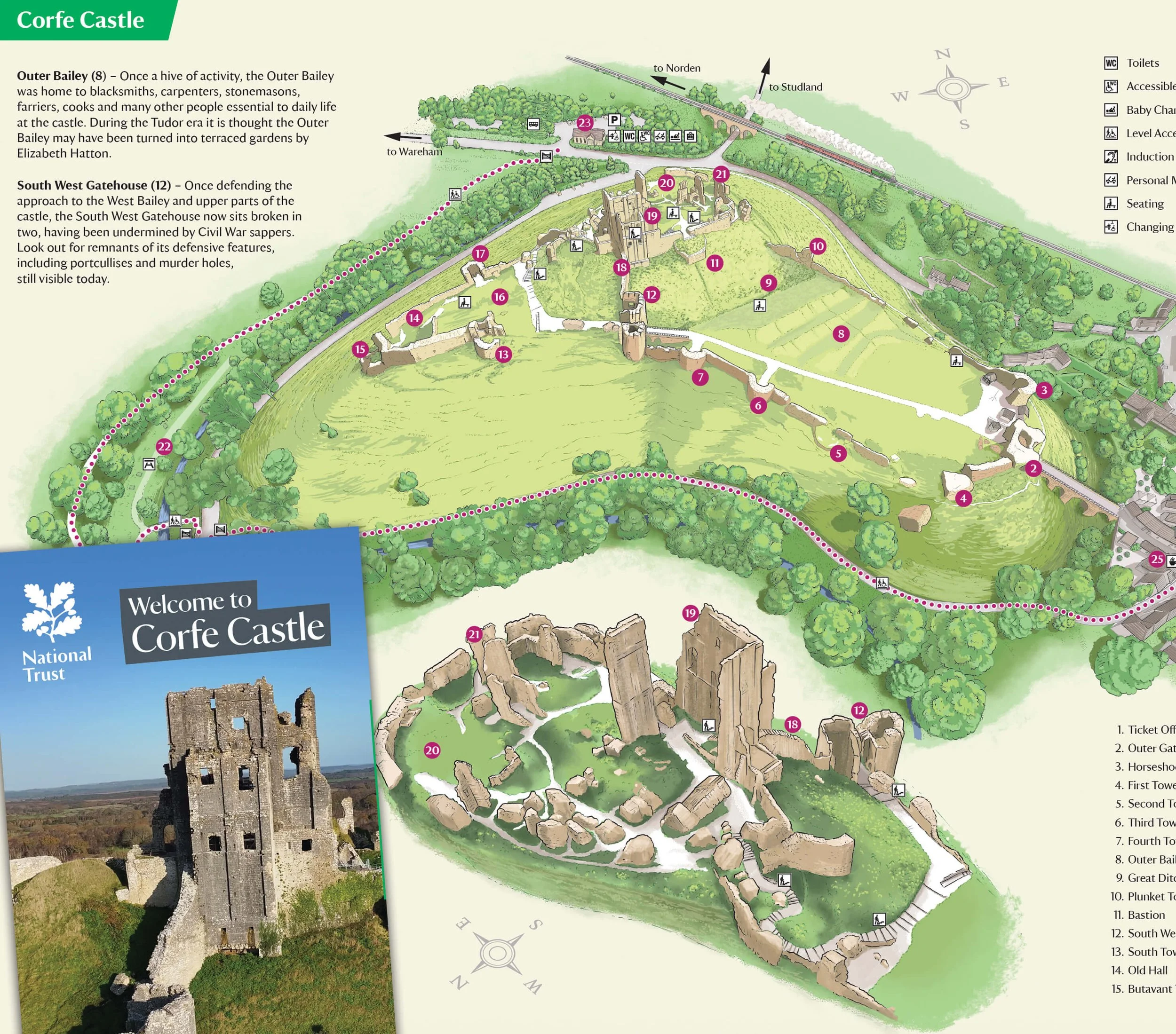
Corfe Castle
Hand illustrated map for the National Trust Corfe Castle showing the key points of interest for visitors and used on the new visitor leaflets.

Royal Lancaster Hotel, London
Illustrated map of Hyde Park for the Royal Lancaster hotel. The maps includes points of interest and different routes around the park for hotel guests to explore.

Boston Park Farm
Map design to show the layout of Boston Park Farm with a key, printed as a large signage board to be used on site.

Newark Park - National Trust
Illustrated site map created for Newark Park.
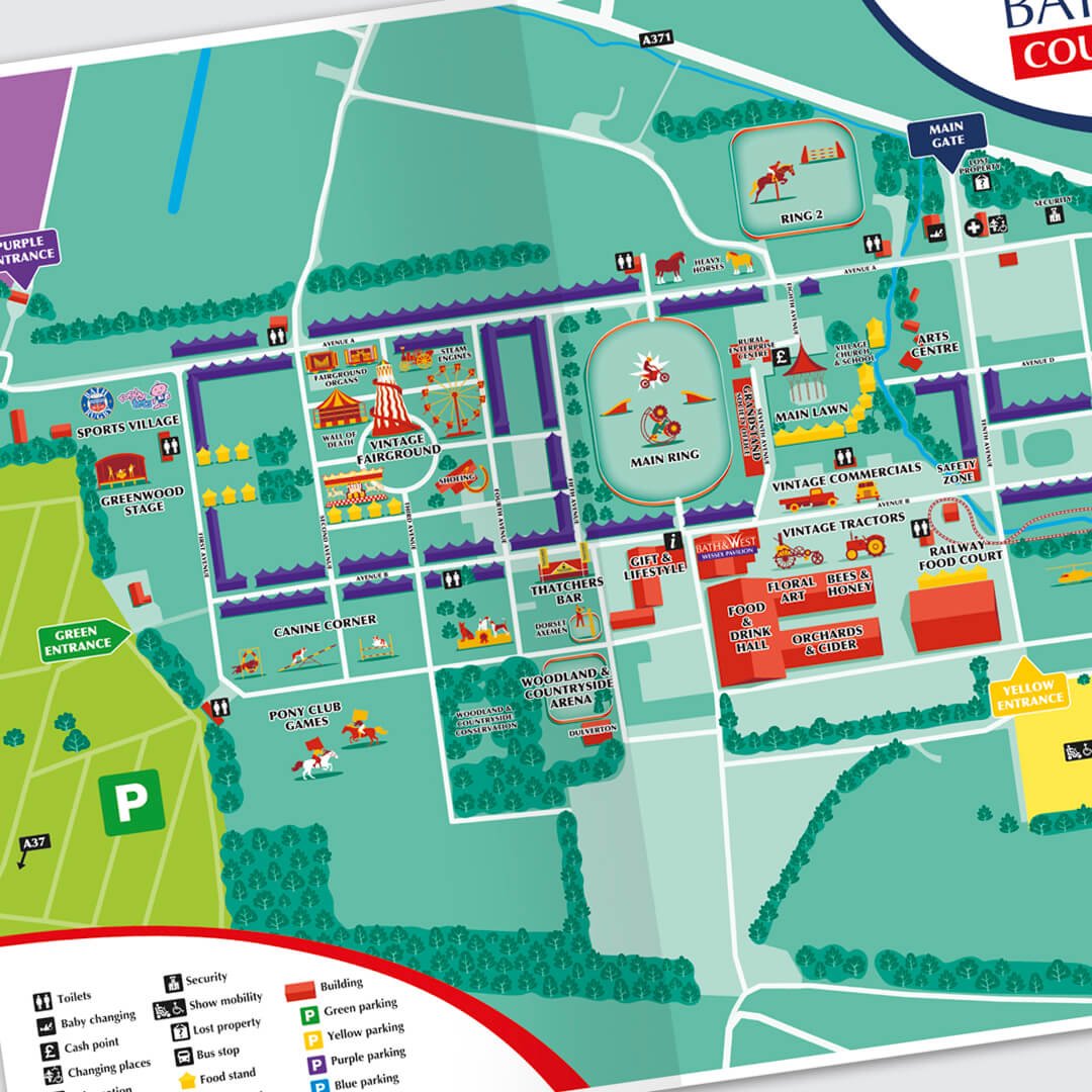
Bath & West County Festival Map
Illustrated site map created for Bath & West Country Festival, 2021. For use on signage and in print.
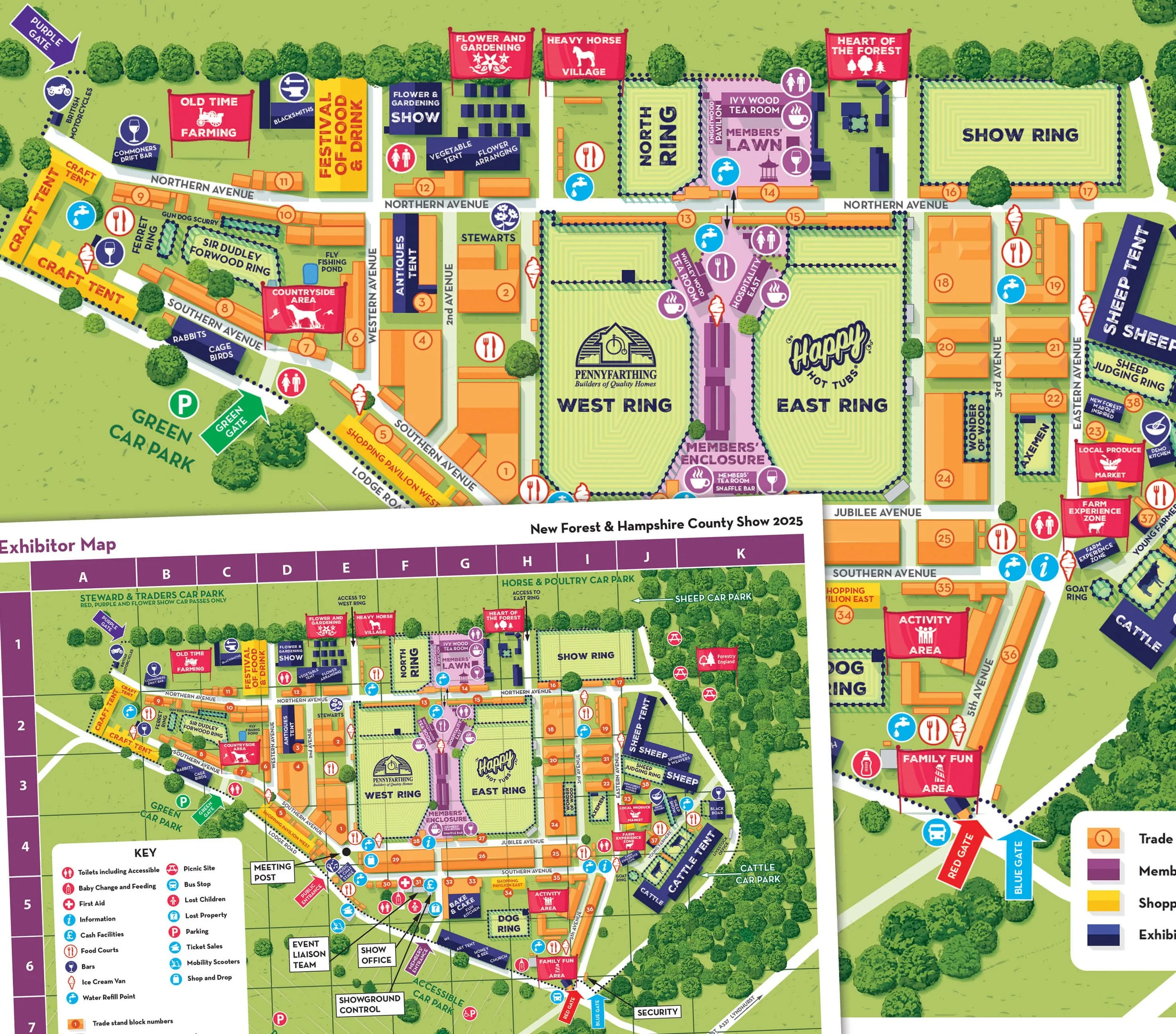
Country Show
Exhibiter map for the New Forest & Hampshire Country Show showing the layout for the stall holders, facilities and members areas.

Army Flying Museum
Fully illustrated map to show the layout of the Army Flying Museum with a key to highlight where visitors can find different exhibits.

Weston Park Site Map
Illustrated site map created for Weston Park, to be used in printed guides.
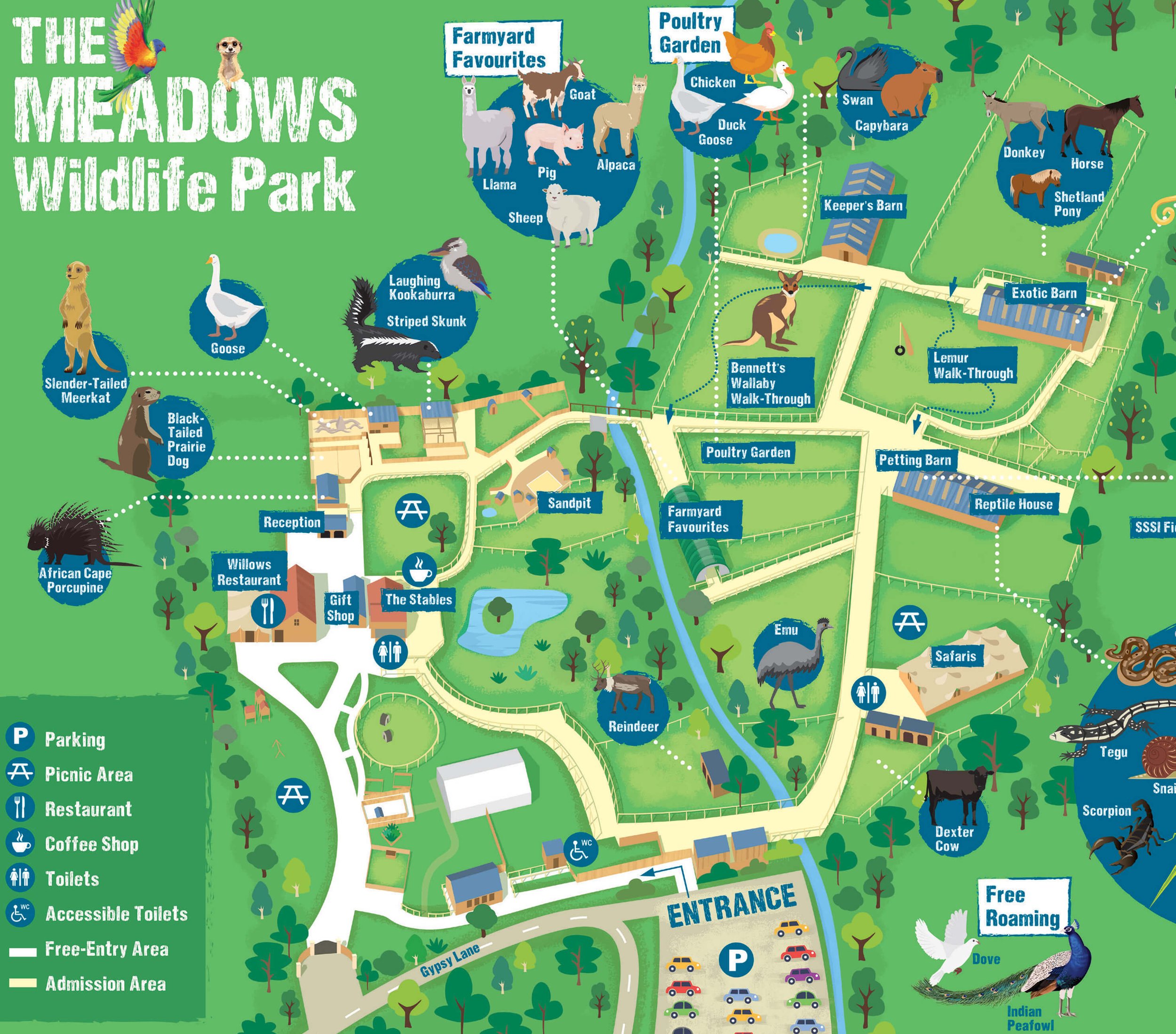
The Meadows Wildlife Park
Illustrated site map created for The Meadows Wildlife Park.

Powderham Food Festival
Food Festival map created for Powderham, including all exhibitors.
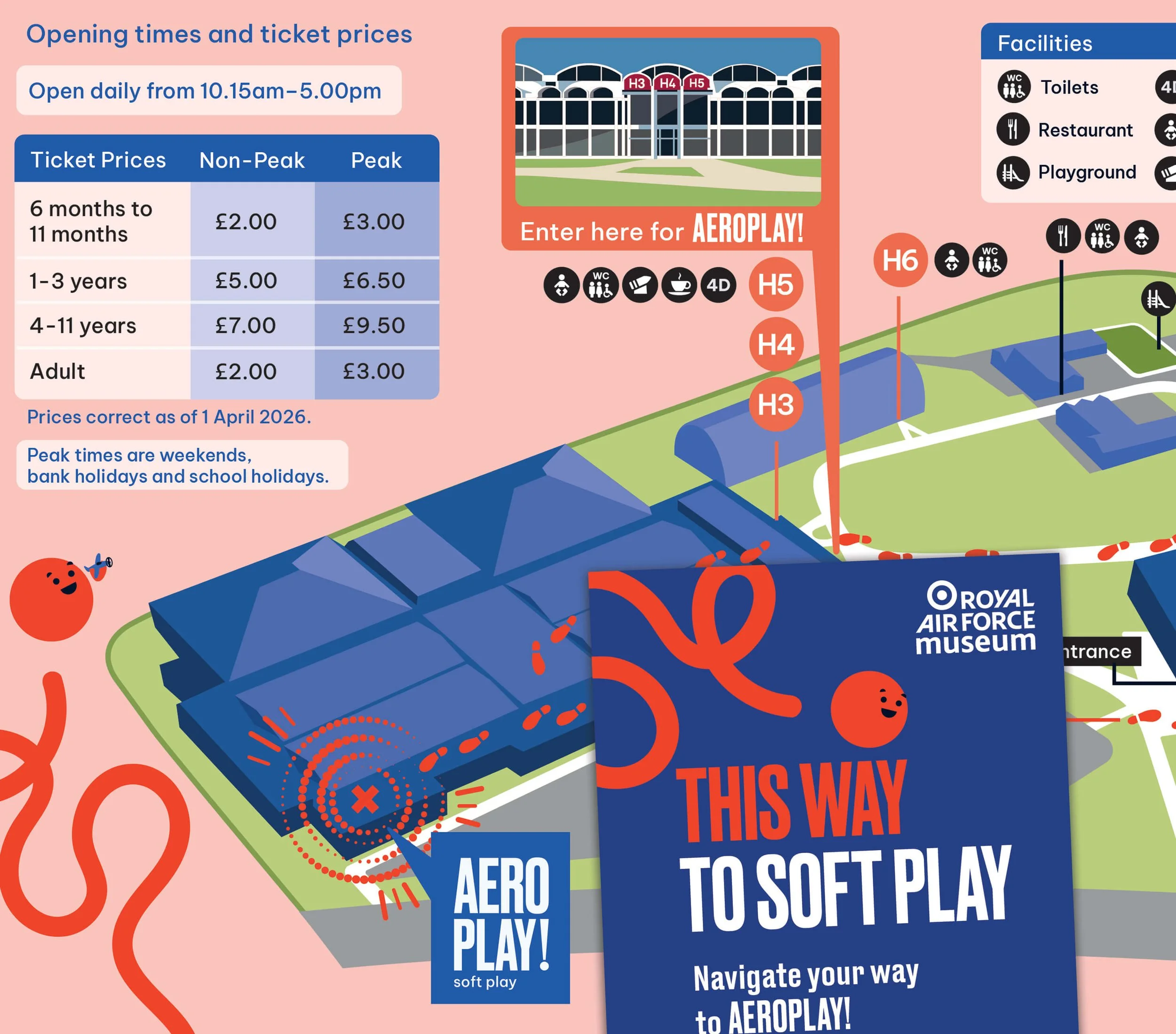
RAF Museum Soft Play
Site map creation for the RAF Museum to guide family visitors to the new soft play centre ‘Areoplay!’ inside the Royal Airforce Museum.

Fairytale Farm
Illustrated site map created for Fairytale Farm with key to show different visitor attractions on site. Used on signage and in visitor leaflet.

Glamis Castle
Hand illustrated map for Glamis Castle showing walking routes around the grounds and points of interest for visitors to explore.

Avon Valley Site Map
Illustrated site map created for Avon Valley. The map was used for large signage and on web and print.

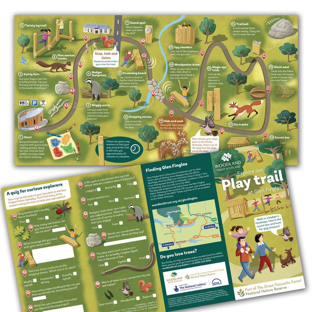
Glen Finglas - Woodland Trust
Fully illustrated play trail created for Glen Finglas, Woodland Trust.
“Colour Heroes produced a new park map and leaflet which was a fantastic layout and design. Our visitor numbers that year increased by 15%, and I am certain that the new park map and leaflet contributed to that.”